 |
| Mount Saint Helens |
After our short tour of the Olympic Peninsula we were keen
to show our girls another of the highlights of Washington
State and for a time at least perhaps
the most famous feature there - Mount Saint Helens.
We met up once again with my cousin Mark, this time with his girlfriend. This
was a trip we wanted to do with him as he is a geologist and I knew a long time
ago that this was near the top of his wish list of things to do. What we
hadn't bargained for was the searing hot temperatures - it was more than 100
degrees Fahrenheit when we arrived and we knew then that we would probably have
to curtail the walking that we had planned. As with the Olympic trip this
entry will be a series of interpretive walks that set the scene for the
monumental events that surrounded this mountain back when I was a boy in 1980.
 |
| Silver Lake Lily |
Mount Saint Helens famously
erupted in May 1980 with the world watching. The media attention on this
eruption was unprecedented at the time and I have enduring memories of watching
the footage and the enormous ash cloud that was ejected from the top of the
mountain. This ash cloud would affect great swathes of Washington and affect the global climate for
a period afterwards as sunlight was reflected back into space. The local
area was devastated and millions of trees were toppled and/ or
incinerated. It wasn't just ash that was emitted though - about 3000 feet
of mountain also blew off the top in the explosion! Much of the
interpretation around the mountain now focuses not just on the eruption but the
nearly forty years of regeneration that has happened since.
 |
| Silver Lake |
We stayed close to the nearby freeway to allow us the
opportunity to visit the two main areas north and south where the highlights of
what can be seen are found. We started on the north side if the mountain and
headed up the highway that leads up to the Mount Saint
Helens observatory and stopped at the first visitor centre.
This was a great introduction to the mountain, it's geological history
and the events that led to the explosion that happened in May 1980. A
film showing the devastation caused was shown and this was a really good way of
telling the story to the girls.
 |
| Mount Saint Helens From Silver Lake |
Perhaps better than the indoor section was the walk outside
on the boardwalks of the Silver Lake Wetlands Trail. This gave us our
first proper sight of the mountain but also some beautiful scenery as we
wandered around a lily pad lake. At the far end of the boardwalk we
eventually walked along a narrow strip of land between the lakes. It
turns out that this strip of land was actually a railroad originally; built to
carry logs away from the forested area. It seemed a bit unlikely but the
shape of the land was certainly consistent.
 |
| Lava Flow in Toutle River Valley |
We learned that the lake was formed in an earlier eruption
of the mountain, about 2,500 years ago. During this event landslides off
the north side of the mountain blocked local streams and formed lakes behind
the dams of debris. Some of these lakes eventually overflowed, resulting in huge
mud flows that thundered down the Toutle
River. The mud came
to form a dam at nearby Outlet Creek and created Silver Lake.
The lake is actually quite shallow, perhaps this is why the distinctive lily
pads thrive in the conditions? On the way round we also came upon a
touching memorial plaque to the 57 people who died in the 1980 eruption.
 |
| Looming Mountain |
We headed on and soon the road started to climb. We
stopped briefly at an enormous bridge that had been completely rebuilt after
the eruption in 1980. Unfortunately we didn't get a clear sight of it but
the scale was pretty obvious for all to see. We crossed and continued to
climb and the mountain loomed large as we headed upwards. At the next
available viewpoint was another visitor centre, this time devoted to forestry
although there were some interesting elements about how the forests have
recovered after the eruption. The best thing about this point though was
the view - we could see where the ash had been worn away by the river.
 |
| Recovering Landscape |
The last stretch of the drive was a lot steeper as we headed
up to the last of the visitor centres at Johnson Ridge. This is surely
the one with the best view of the mountain and some 15 years after we last
visited and 36 since the eruption there was some recovery but mostly the surrounding
area is a moonscape still. We watched a film about the recovery of the
landscape after the eruption - fascinating stuff. Mostly though the view
was the star here - the mountain this close up is quite astonishing although
the heat was pretty intense. My eyes were also drawn to the pretty
wildflowers that call this area home. They gave some much needed colour
to an otherwise barren looking landscape. There are a lot of walks that start
at Johnston Ridge - we stuck to the modest section of the Boundary Trail at the
top. It is possible though to take some big loops from here that even
include going up to the summit itself. Be warned though - anything more
than a casual stroll and you will need a permit so make sure you are fully
equipped before you set out.
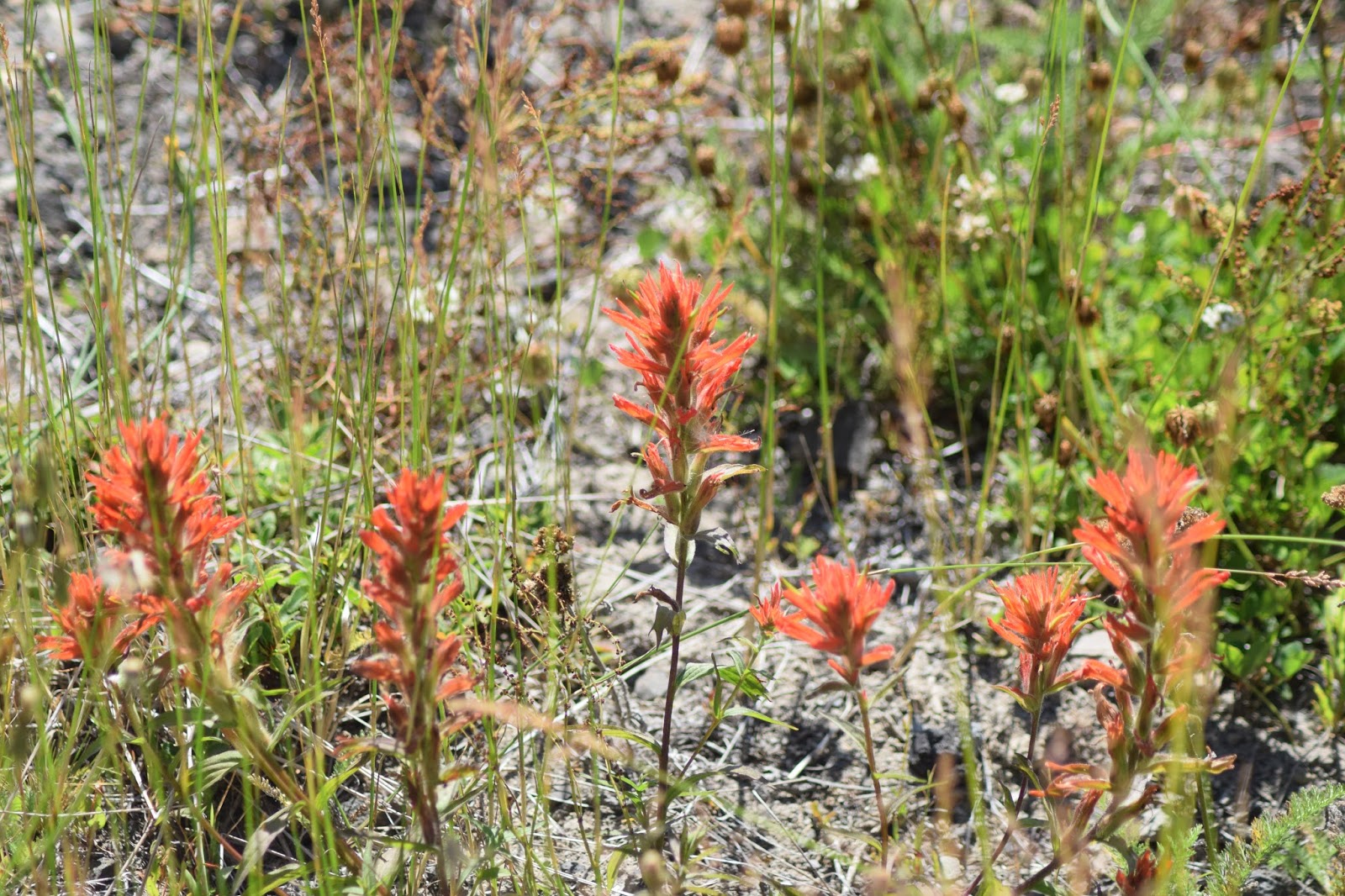 |
| Johnston Ridge Wildflowers |
Having satisfied ourselves with seeing what we wanted to see
we headed back down again. We stopped briefly at Coldwater Lake
at the bottom which was worth the stop for the lovely view across the water.
There was an interesting short boardwalk here as well and this was rather more
bearable to walk around as there was a breeze coming off the lake. There
is a trail that takes walkers right around the perimeter of the lake and it
looks a most inviting walk. At 10 miles and some appreciable height gain
it wasn't one that we could contemplate on this trip. I imagine on an
autumn or spring day it would be a delight.
 |
| Coldwater Lake Boardwalk |
On the second day of our trip to Mount
Saint Helens we went round to the south side of the mountain to
look at some of the other features of the landscape, mostly formed from
previous eruptions. Mount Saint Helens
is the most active of the Cascade volcanoes and there is plenty of evidence of
lava flows from different eruption episodes. One of these is the so
called Ape Cave, which is a lava tube system.
 |
| Coldwater Lake |
We got there reasonably early which was a good thing for the
crowds had already started descending on the place. In order to explore
properly we didn't just rely on the small torches we had but also hired a
couple of gas lanterns from the ranger station. We wandered up to the top
of the cave and descended down the steps into the tube. We decided to
follow the 'lower' tube as this was a lot easier for the girls. In total
the tube is two and a half miles long and was formed when the lava flow cooled
from the outside hardening the rock and leaving a cavity below.
 |
| Ape Caves |
To say it was dark would be a massive understatement and we
were very thankful for our torches and lamps. This is not a cave system
full of stalactites and stalagmites for there is no water. The crystals
of the lava could be seen in places together with evidence of how the lava
flowed but this was not a place a magical beauty, more a reminder of the brute
strength of the nearby mountain. Eventually the route petered out into a
cave far too small to negotiate. The total length of the section we
explored was about a mile and we had to return the same way that we went in.
 |
| A Trail of Two Forests |
On our way out of the Ape Cave
complex we stopped briefly at the Trail of Two Forests. The Two Forests
in question are the present day one and one from ancient times that was
engulfed by a previous eruption of Mount Saint Helens.
This buried a forest in lava, leaving trunk shaped tubes where fallen
trees had been covered in lava and subsequently burned/ rotted away leaving the
hollow where they had once been.
 |
| Lava Tube |
The trail itself was largely on boardwalk above the lava to
protect it from the hundreds of feet that would otherwise erode it. At
the far end was a tunnel that could be accessed via a ladder and the girls and
I gave it a go. It was a fairly tight fit and the roughness of the rock
made for a slightly uncomfortable experience, but was a fascinating feature!
I was certainly glad to explore this place - glad we stopped.
 |
| Lava Canyon Bridge |
The last place we visited on our trip to Mount Saint Helens
was the intriguingly named Lava
Canyon. Of course it was
still a river of molten lava but rather the remnants of an old eruption.
As we approached we went past the opposite side of the volcano than we
were yesterday. We parked at the top of the Canyon and descended to river
level. It was clear pretty quickly that the river was doing its best to
wear away the lava but it was still quite clearly a lava flow!
 |
| Lava Canyon |
The river raged underneath the bridge that we crossed and
fell down through a fissure in the rock to find lower ground. Warning
notices were quite prominent advising people that trying to go in the water is
generally fatal. I imagine that a few people have found that to their cost.
 |
| Lava Canyon |
We continued down the valley for a short way and took a look
at some of the lava formations as we did so. It looked as if there had
been several episodes of eruptions judging from the different layers of lava
that we saw. There was also what looked like a lava bomb settled on the
top of one of the beds. The piece de resistance of the walk was the crossing of
a wibbly wobbly bridge halfway round. High above the raging torrent below
it was all a bit Indiana Jones but definitely added a lot of spice to the walk!
 |
| Suspension Bridge |
On the other side of the canyon we traced our path back to
the car seeing a rather different view of the rocks we had walked on over the
other side. We could see the columnar jointing pattern of the basalt,
which was rather fascinating. It was also interesting to see that
although the forest had taken back control of much of the landscape the rock
close by the water was still almost as fresh as the day it was created.
Other than a few lichens not much had managed to establish itself on the
rock. I imagine that this might hold true until the next eruption comes
this way!
 |
| Basalt Columns |
Sadly this was the end of our time together and we faced the
long journey back to Bellingham
after saying goodbye in mid afternoon. I was a little sad that it had been too
hot to explore more on foot but in truth this is a vast area and two days are
not nearly enough to explore properly. If you have the time take at least
4-5 days. I have no doubt that we'll be back!
No comments:
Post a Comment